



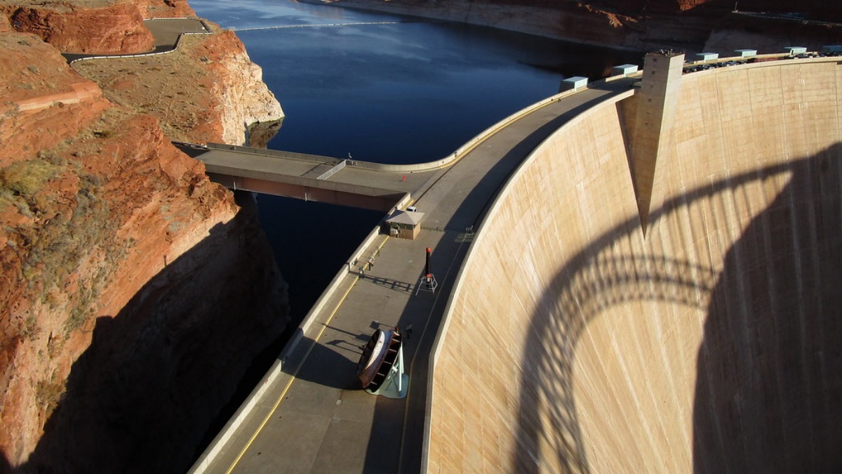

Lake Powell, the second-largest reservoir in the United States, has fallen to its lowest water level ever recorded. The reservoir supplies water and electricity to millions of people across the western US, and its decline marks the latest development in a long-running crisis affecting the Colorado River.
Water levels at the reservoir dropped to 3,519.91 feet on Saturday. This broke the previous record low of 3,519.92 feet, which was set in April 2023, according to data published Sunday by the US Bureau of Reclamation.
According to CNN, the reservoir is now just under 30 feet away from the point where its dam would no longer be able to produce hydropower.
Lake Mead also hit a historic low nine days earlier
The new record at Lake Powell comes nine days after Lake Mead, the largest reservoir in the country, fell to its lowest level since it was first filled nearly 90 years ago. Jack Schmidt, director of the Center for Colorado River Studies at Utah State University, described the situation directly: “We are in uncharted territory.”
Lake Powell and Lake Mead function almost like one large reservoir, split by the Grand Canyon. Together, they hold just under 60% of all the water currently stored in the Colorado River basin. Both lakes have been shrinking for more than 20 years, and their decline reflects the wider troubles facing the river system that feeds them.
The Colorado River begins in the Rocky Mountains, where it is fed by melting snow, and flows down to the Gulf of California in Mexico. It supplies water to about 40 million people and irrigates more than 5 million acres of farmland across seven states: California, Arizona, Nevada, New Mexico, Wyoming, Colorado, and Utah.
Since 2000, the river has shrunk by roughly 20%. This has been driven by drought linked to climate change, rising temperatures, and years of heavy water use. Lake Mead and Lake Powell have both been strongly affected by these changes. These pressures come as separate federal decisions have raised concerns about protections for coal plant wastewater that flows into rivers and lakes elsewhere in the country.
Lake Powell sits between Arizona and Utah and was formed behind the Glen Canyon Dam, built in the 1950s. The reservoir began filling in 1963 and took 17 years to reach its full level of 3,700 feet above sea level. It is often described as a water “bank account” that can be drawn on during dry years to supply cities, farms, and businesses downstream.
The reservoir’s level naturally rises and falls each year. Between May and July, it typically gets a boost from melting snow runoff, then gradually drops for the rest of the year. This seasonal pattern leaves behind “bathtub ring” marks along the rocky shoreline. This year, like several recent years, Lake Powell has received very little snow, following one of the driest and warmest winters on record in the western US.
The falling water level raises concerns about electricity production. The Colorado River powers eight large turbines at the Glen Canyon Dam, generating enough electricity each year to supply nearly 500,000 households. Colorado, Utah, Wyoming, New Mexico, Arizona, Nevada, and Nebraska all rely on this power.
If levels keep dropping, the reservoir could reach “minimum power pool” at 3,490 feet, the point where water would be too low to turn the turbines and generate electricity. Brad Udall, a senior water and climate research scientist at Colorado State University, said this “scary threshold” will be reached this year unless “extraordinary measures” are taken, including cuts to water releases from Lake Powell and areas upstream.
An even more serious scenario would involve Lake Powell falling below 3,370 feet, known as “deadpool” level. At that point, water would no longer be able to flow downstream from the dam at all. Schmidt said this outcome is hard to imagine. “I would expect draconian steps to decrease water use to prevent this from occurring. But who knows?” he said.
A spokesperson for the Bureau of Reclamation said the agency and the Department of the Interior remain “committed to reducing the collective risk of both Lake Powell and Lake Mead falling below critical elevations to protect critical infrastructure to continue to meet the water and hydropower needs of the basin.”
Experts say there is currently no risk of taps running dry for the public, since the Colorado River’s decline has unfolded slowly and many water managers have already taken steps to prepare. Sarah Porter, director of the Kyl Center for Water Policy at Arizona State University, said cities like Phoenix and Tucson “are extremely aware that they are first in line for cuts” and have arranged backup water supplies to meet demand.
She noted that while cities are often able to pay for alternative water sources, this option may be harder for tribes and smaller communities along the river. Concerns over drinking water safety have also surfaced at the federal level, where regulators have faced criticism over rules on cancer-linked forever chemicals in public water systems.
The record low at Lake Powell comes as the seven states that share the Colorado River’s water wait to learn what cuts will be required of them. Years of negotiations between the states failed to produce an agreement, so federal authorities have stepped in. A plan outlining the exact water reductions required through 2028 is expected to be published in the coming days.
There is some hope that the El Niño climate pattern, which tends to bring more rain and snow to the Southwest, could help ease the crisis. However, experts say one wet winter alone will not be enough to fix the problem. Porter said, “Even record snowpack this winter will not be enough to get us out of the danger zone.”









Published: Aug 17, 2026 10:45 am